Geospatial Real Estate Valuation
Analytics · Tableau
Geospatial Real Estate
Geospatial Real Estate
Valuation
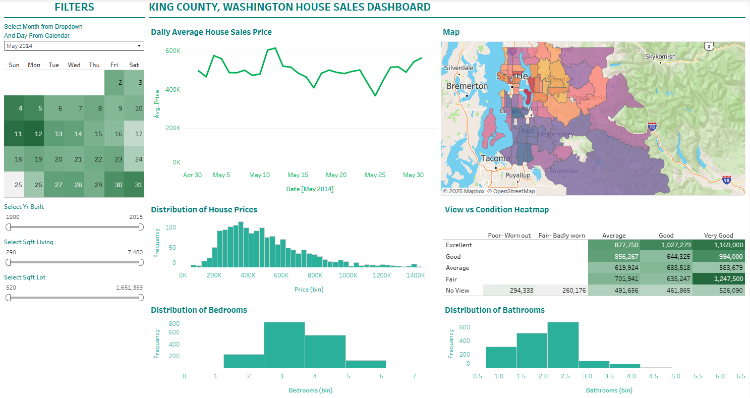
A dynamic geographic mapping tool for King County housing records. This dashboard filters property valuations by condition and build year to show exactly how much location changes market prices.
Real estate pricing is notoriously difficult to visualize in a spreadsheet. I took raw housing records from King County, Washington, cleaned them in Excel, and normalized them into a dynamic Tableau map. This allows users to visually filter properties by condition, square footage, and build year to instantly see neighborhood pricing ceilings and spatial market trends.
Interactive Tableau Map: Filtering King County property valuations by location and condition.